
TURF Insight Platform v2.0 unifies high-resolution aerial mapping, field capture, and precision machinery exports into one secure spatial database. Decisions don’t depend on memory, paper maps, or tracking down the right person.
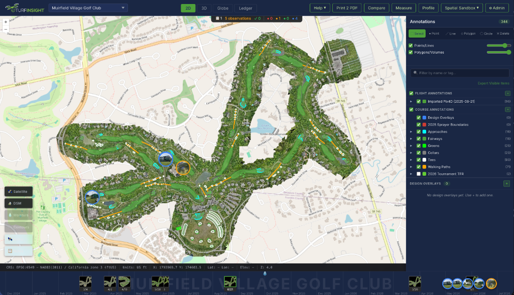
On most courses, no single person knows where everything is. Irrigation details live with one long-time irrigator. Drainage history is remembered by a former assistant.
Superintendents spend hours chasing paper drawings, text messages, or interviewing retired crew members to find valves or lines.
Renovations, drainage layouts, and tree removal logs live in hand-drawn notes, fading markers, or are entirely forgotten after staff transitions.
Autonomous sprayers and mowers are configured with manual eyeballing, leading to chemical skips, spray overlap, and machine boundary collisions.
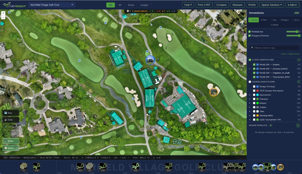
Every catch basin, pipe, and tree is georeferenced on-site using sub-inch RTK GPS coordinates and mapped directly onto your dashboard.
Document tree inventories, tournament setups, and infrastructure changes as work is done. Preserve course context forever so it survives project turnovers.
One-click sanitized shapefile boundary exports for Toro GeoLink sprayers and mower inclusion/exclusion zones ensure seamless and automated equipment operation.
Plain-Language Overview. Built around how golf courses actually change.

TURF Insight starts with a current, accurate map of your golf course and grows from there.

New drainage is added. Irrigation gets modified. Trees are removed. Changes are recorded directly on the map.

Nothing gets lost. Nothing has to be recreated later. The record improves over time.
Irrigation and drainage information often lives in fragments. TURF Insight brings that together into one clear record so you can see known lines, add notes when work is done, and reduce guesswork before trenching.
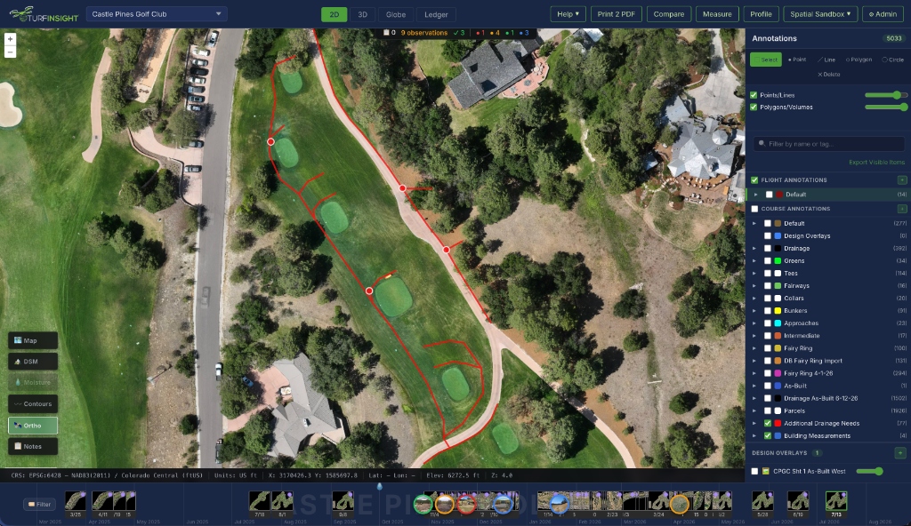
Automated sprayers and autonomous mowers depend on accurate definitions of the course — fairways, approaches, greens, collars, rough, and cutting areas. The challenge for superintendents isn’t the equipment itself. It’s setting it up correctly and keeping it updated as the course changes. When the course changes, the data changes with it.
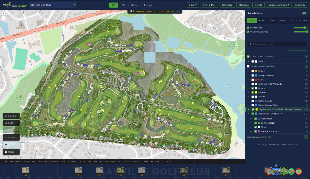
Renovation knowledge often disappears once a project ends. TURF Insight preserves before conditions, after conditions, and notes on why decisions were made. Track tree removals, additions, and canopy changes so future decisions aren’t based on memory alone.
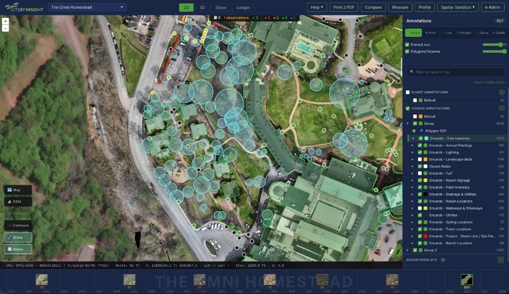
Stop starting from scratch every year. Document tent locations, ropes, fencing, and temporary infrastructure so next year’s planning starts with last year’s answers. Plan facility locations, stake out layouts, and register temporary utility infrastructure on a georeferenced grid.
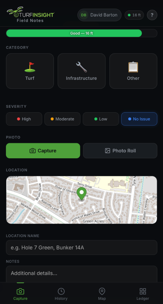
Capture the work as it actually happens. Crew members use their phone camera roll to log georeferenced observations on the course. Spatially locate and orient photos with your living as-built documentation to preserve course context forever.
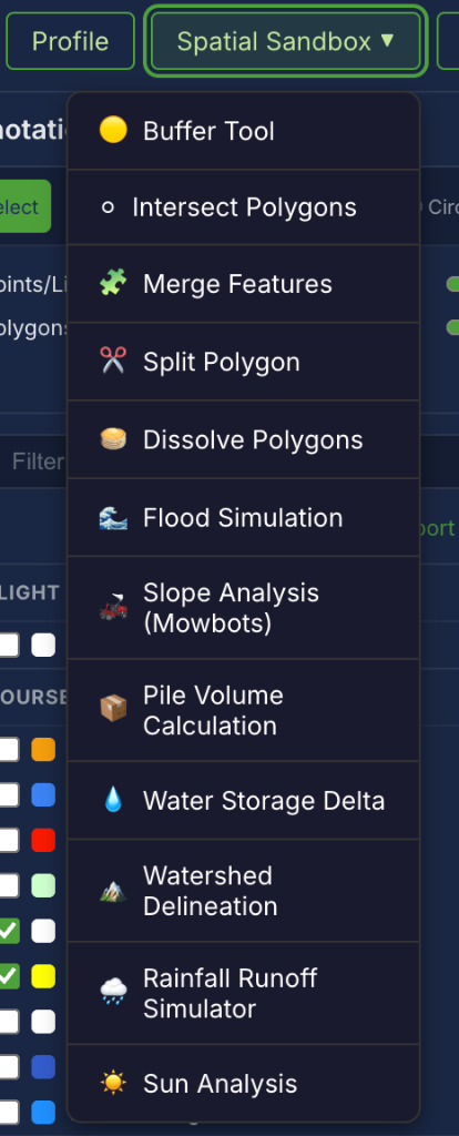
Don’t guess. Run physics-based simulations and vector analyses to audit moisture flow, tree shade, slope hazards, and earthwork volumes. The Spatial Sandbox turns your course maps into an active operational laboratory, enabling data-driven agronomic and budget decisions.
Simulate water accumulation and model rainfall runoff paths across the course to identify pooling areas.
Cast solar shadows for any date and time to measure tree canopy light restrictions and turf grass health.
Automatically map localized catchment areas and drainage flows using digital terrain models.
Draw boundaries around sand, topsoil, or gravel stockpiles to compute volume and tonnage audits in seconds.
Perform precise spatial calculations with our Buffer Tool, Polygon Intersection, Feature Merges, and Split lines.
Assess fairway and rough gradients to establish safe boundaries and path routes for autonomous mowers.
TURF Insight is not a legal survey. It is built with field discipline — not guesswork.
Every coordinate is registered directly from the field rovers and DJI flight lines, ensuring precise ground alignment.
Uses standardized geodetic anchor points to keep layers aligned across weeks, months, and years.
No guestimates or eyeballing satellite tiles. Rely on physical survey calculations and elevation scans.
TURF Insight was shaped by real conversations with superintendents who were tired of chasing information, relying on hearsay, and losing history when people leave. It exists to make course knowledge visible, durable, and useful.
START WITH WHAT YOU’RE WORKING ON NOW. You don’t need a big rollout. Most courses start TURF Insight by focusing on: A drainage problem, Irrigation updates, Tree work, or an upcoming event.